
The Traffic Light System (TLS) evaluates logical rules that compare observed conditions with criteria for compliance to a particular scheme or measure. It assigns one of the following codes to each FOI (feature of interest — an agricultural parcel):
- Green — FOI assessed and confirmed as compliant.
- Yellow — FOI assessed, but there is insufficient evidence to either confirm or explicitly reject the declared scheme/measure.
- Red — FOI assessed and confirmed as definitely non-compliant.
The TLS for the basic payment scheme in Slovenia covers eleven different scenarios; each scenario incorporates markers and rules and is specially tailored to a specific land-use or crop type. Scenarios are adjustable to the business rules of each country's Paying Agency: the marker system and the TLS are configurable, and the Expert App — which also supports manual evaluation — enables detailed review phases to check and optimize algorithms and decision thresholds.
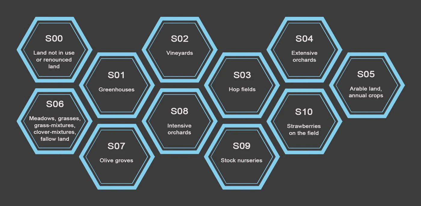
The TLS scenarios for the Slovenian basic payment scheme.
The markers TLS relies on
Within the basic payment scheme, it is more important to distinguish whether parcels are actually managed with some definite agricultural activity than to prove the claimed crop is the one grown. If evidence of any farming activity is found among the markers and signals for a FOI, that FOI is assigned Green — even if, for example, corn is cultivated on a FOI claimed as winter wheat. The TLS searches for evidence of the presence or absence of farming activity using these markers:
| Marker | Role in the TLS |
|---|---|
| Mowing marker | Searches for evidence that a FOI has been mowed. |
| Bare-soil marker | Searches for evidence that a FOI has been ploughed. |
| Crop-group classification, similarity, and Euclidean distance markers | Check consistency of a claim. If a FOI's signals are consistent with other FOIs having the same claim, that is indirect evidence of farming activity — corn, winter wheat, or vegetables do not grow by themselves without ploughing, sowing, and harvest. |
| Land-use marker (with similarity and distance markers) | Checks consistency of a claim of permanent crop — for example, hops or fruit trees. |
| Homogeneity marker | Identifies FOIs with heterogeneous land use that produces noisy signals which cannot confidently be assessed by the other markers. |
| Mean-NDVI marker | Identifies FOIs with very little vegetation cover — for example, a parcel turned into a built-up area. |
The two most important scenarios in most countries are probably Scenario 5 (arable land / annual crops) and Scenario 6 (meadows and grasses) — in Slovenia they represent over 90% of all FOIs. The rest of this article walks through the decision logic of these two scenarios, as documented for Slovenia in 2021. In these walkthroughs each parcel ends Green (markers provide evidence of farming activity) or Yellow (they do not); Red is not automatically assigned at the moment, though this will change in the future.
Scenario: annual crops on arable land
In Slovenia in 2021, 171,365 FOIs claiming to cultivate annual crops on arable land were monitored with Sentinel-2. Of those, 155,856 received a Green assignment simply because the predicted crop group was consistent with the claimed one.
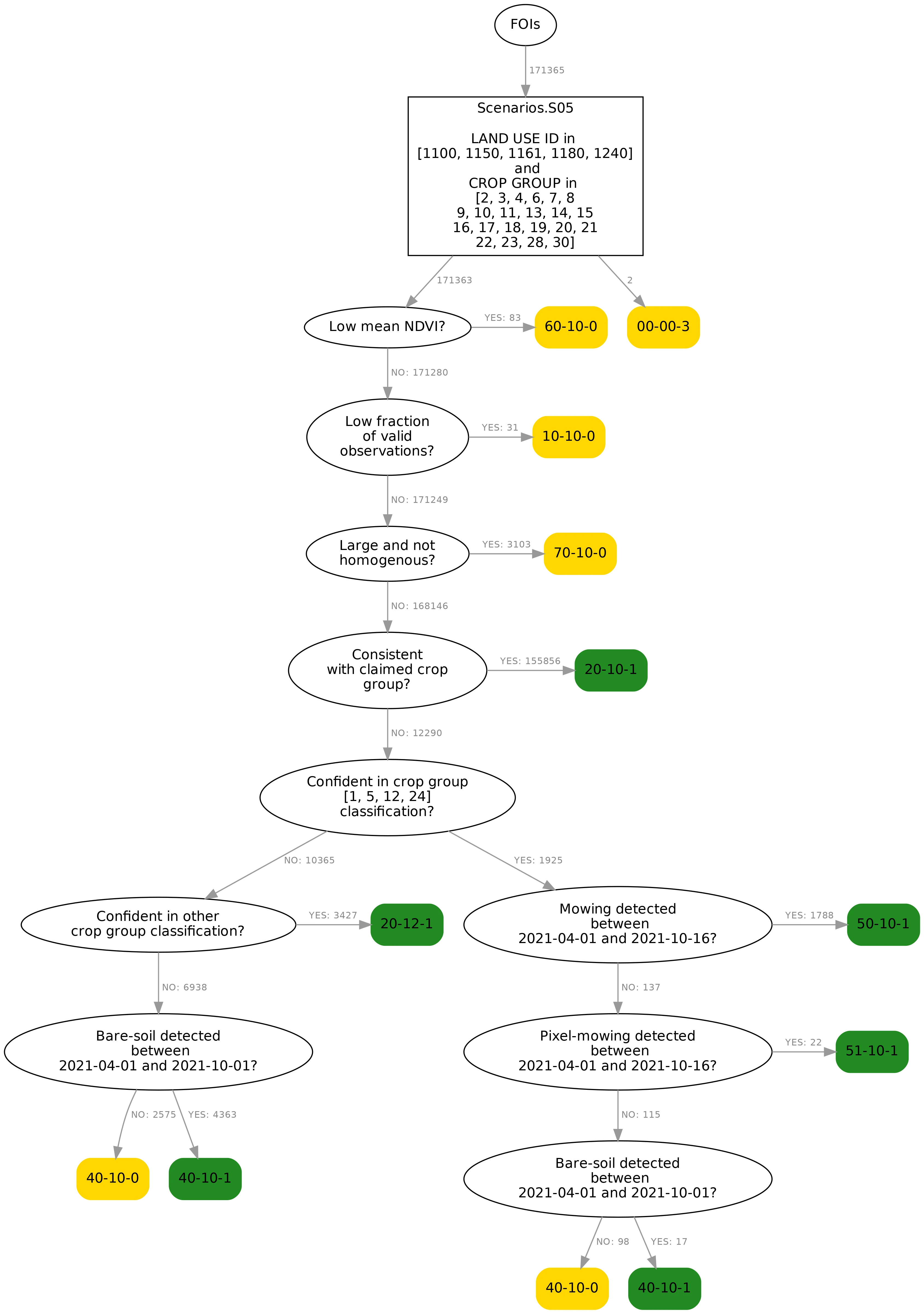
The decision tree for FOIs growing annual crops on arable land. Numbers next to branches show how many FOIs pass through each branch.
The decision nodes:
- Valid observations check. FOIs with no or very few valid Sentinel-2 observations can't be confidently processed by the markers and are tagged Yellow.
-
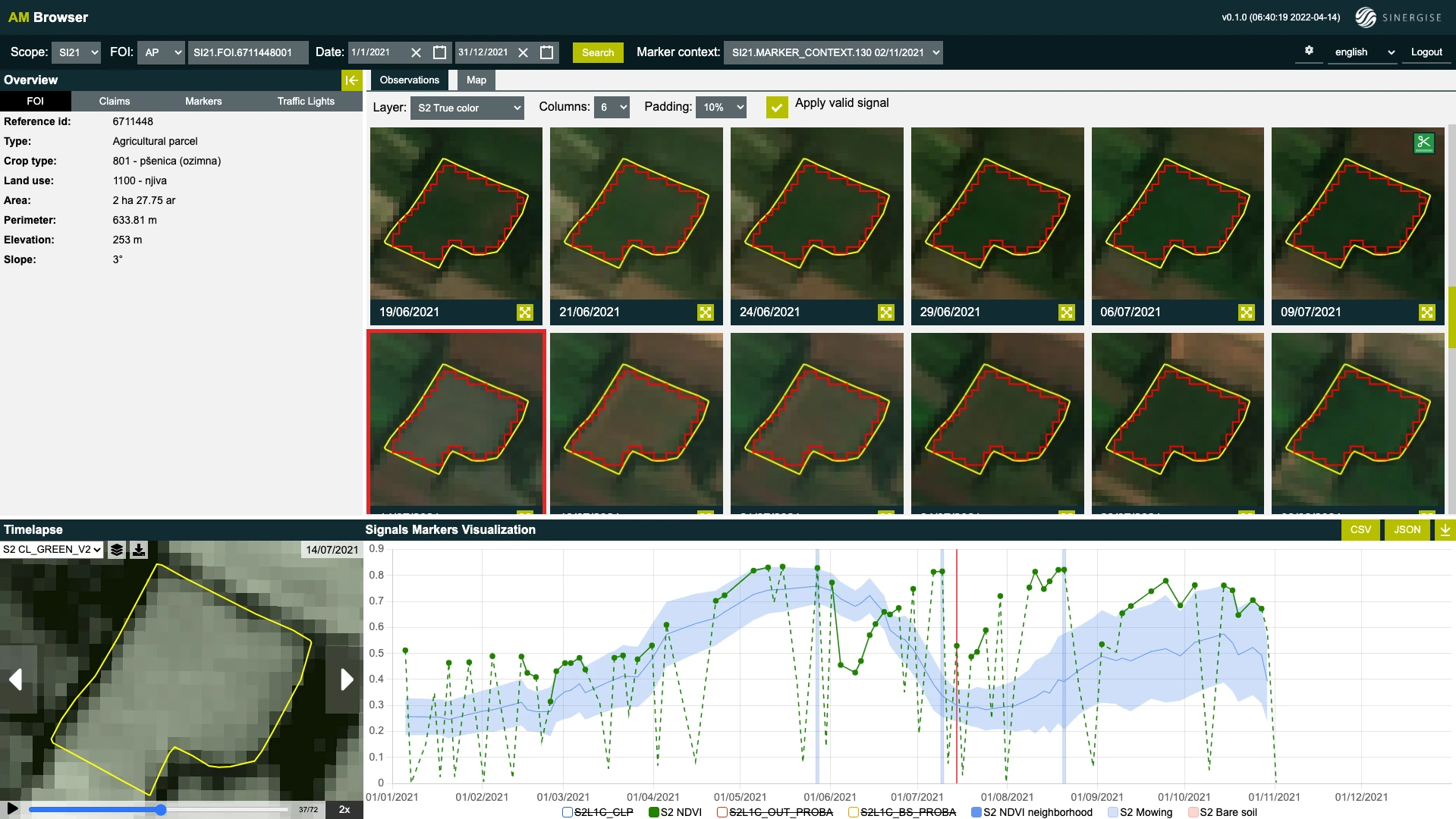
Low mean NDVI. The FOI's NDVI, averaged over all valid observations during the main growing season (May 1 – October 15), must exceed a threshold. Vegetation should cover a FOI for at least part of the season; if it's present only briefly or not at all, the area may not have been used for farming. Example: a FOI claiming corn showed exposed bare soil for most of the season — the data suggests no crop was sown.
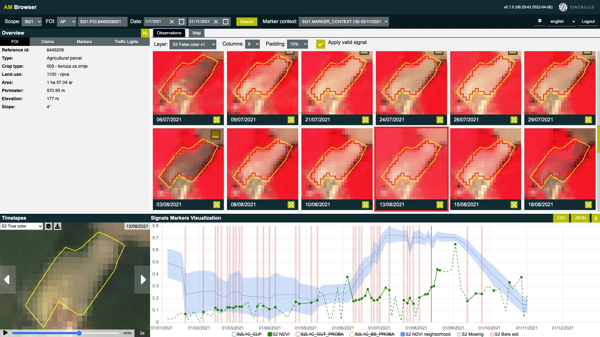
A FOI claiming corn whose signals show bare soil for most of the season.
-
Large and not homogeneous. The homogeneity marker checks whether the FOI represents one homogeneous land use or crop type. FOIs with at least 9 Sentinel-2 pixels and a homogeneity output below a threshold are declared heterogeneous — for example, a parcel where a crop was cultivated on one half while the other half stayed bare until June.
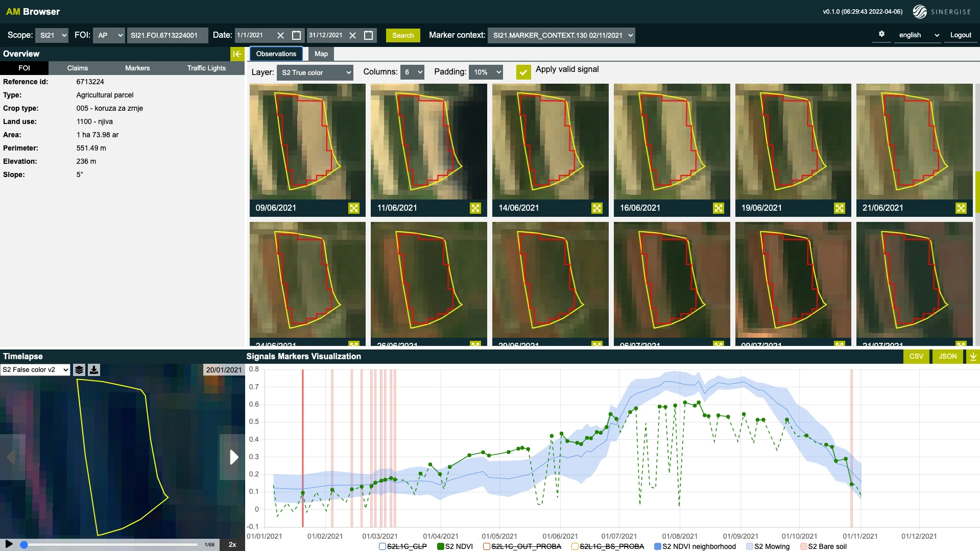
A heterogeneous FOI claiming corn: its NDVI does not follow neighboring cornfields because only half the parcel is cultivated with corn.
- Consistent with claimed crop group. Consistency is checked by the crop-group classification, similarity, and distance markers, used as a proxy for detecting farming activity (annual crops don't grow by themselves). Importantly, a FOI that fails here is not yet assigned Yellow: the basic payment scheme's main requirement is that farmland is farmed, not that a specific crop is grown. The remaining nodes look for any evidence of farming.
- Crop-group prediction consistent with grassland. FOIs inconsistent with their claim are split in two: those predicted to grow grass, clover, grass-clover mixtures, or permanent meadow (where the expected activity is mowing), and those predicted to grow some other annual crop (where the expected activity is ploughing). Each group is then tested for its expected activity.
-
(Pixel) mowing detected. For the grass-like group, a detected mowing event earns Green. Example: a FOI claimed as winter wheat where classification and similarity markers both suggested a grass-like crop — the mowing marker detected events in June, July, and August, so the parcel is clearly being farmed.
A FOI claimed as winter wheat where the markers suggest a grass-like crop; three mowing events were detected.
-
Confident in other crop group. If the crop-group classification marker is confident that a different crop is cultivated, the FOI still gets Green — what matters is farming activity, not the specific crop. For example: "claimed winter barley; predicted corn," where bare-soil observations before sowing and after harvest confirm normal farming. (One instructive case: winter wheat and winter barley have such similar NDVI time series that the model often predicts one where the other is claimed.)
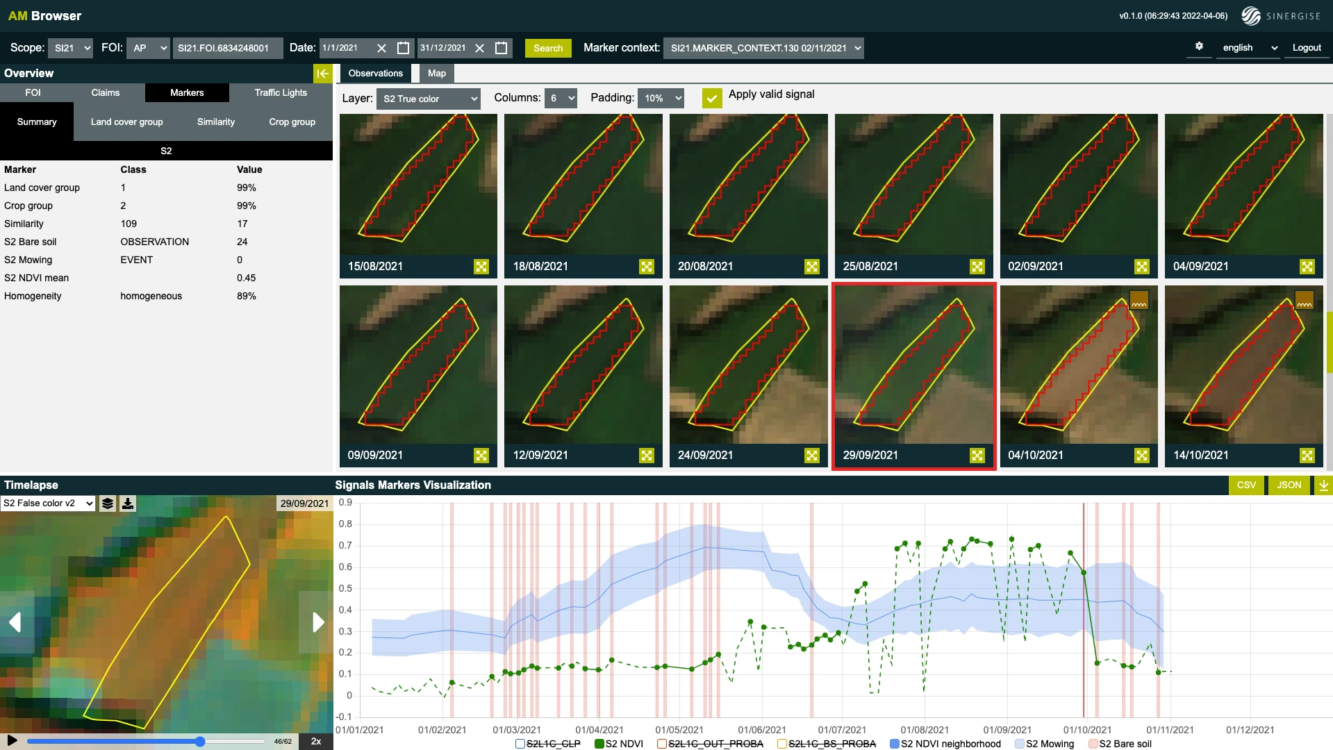
Claimed winter barley, predicted corn: bare-soil observations before sowing and after harvest confirm the parcel is farmed.
-
Bare-soil detected. Finally, detected bare soil indicates the FOI was ploughed and therefore farmed. A FOI claiming triticale with an unconvinced classification marker still earned Green from two bare-soil observations in early June followed by a rapid NDVI rise. For example, a FOI claiming corn where it seems vegetation never really develops and bare soil is not detected ends Yellow, since no evidence of farming is found.
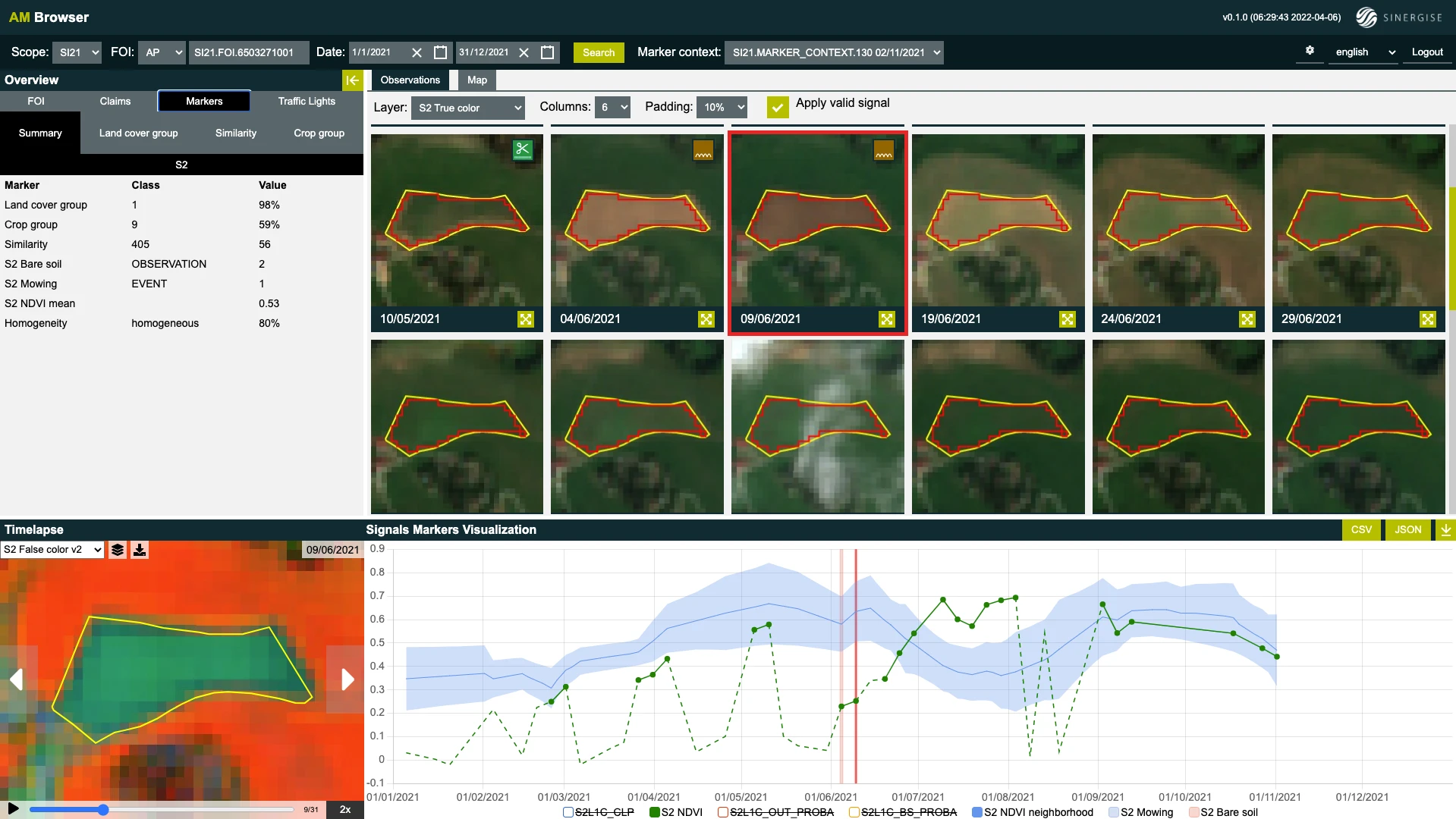
Green: a FOI claiming triticale with two bare-soil observations in early June followed by a rapid NDVI rise.
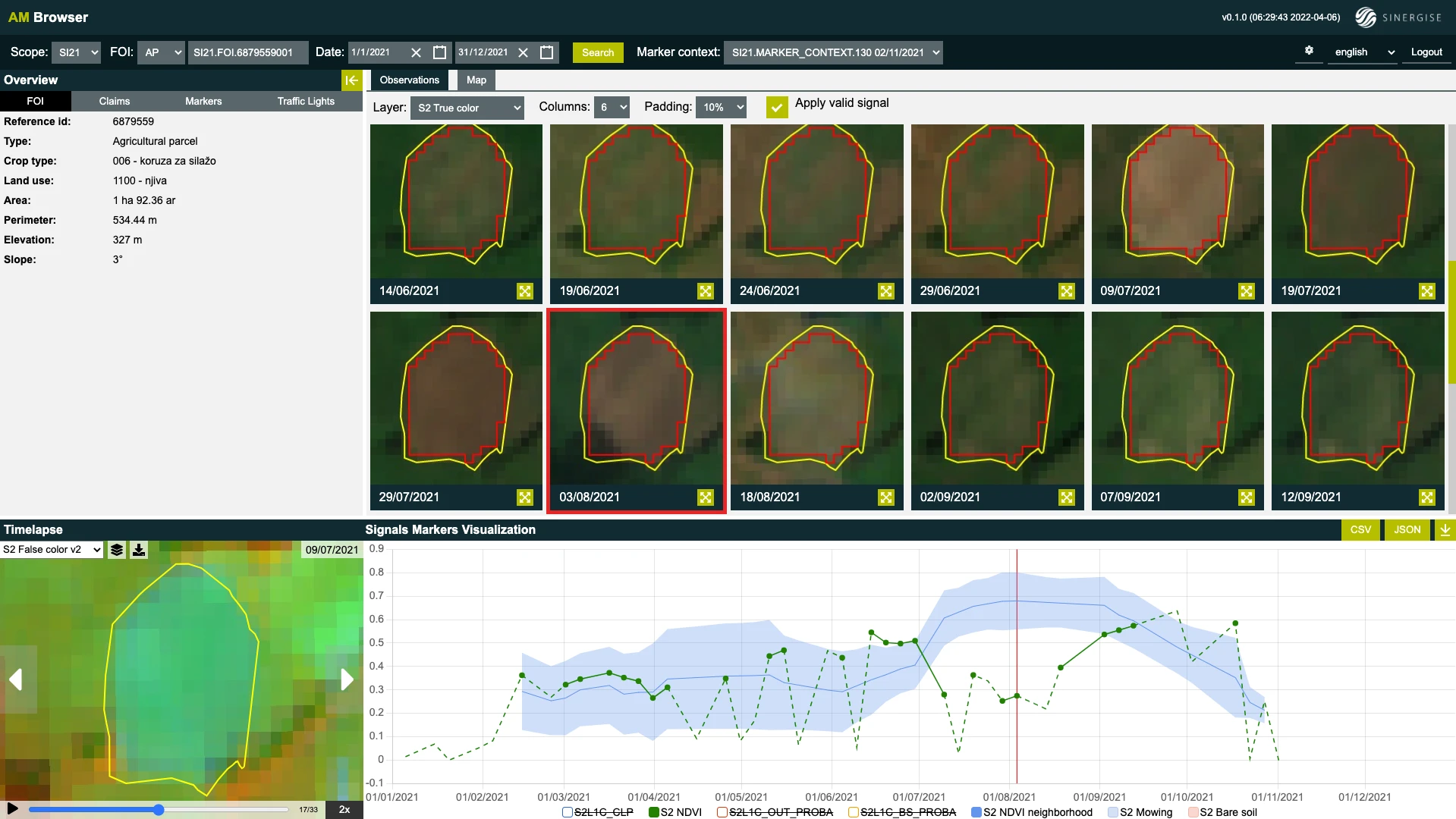
Yellow: a FOI claiming corn where vegetation never develops and no bare soil is detected.
Scenario: grassland
Grassland FOIs — grass, clover, and grass-clover mixtures up to five years on arable land, plus permanent meadows — numbered 394,739 in Slovenia 2021, more than half of all monitored FOIs. Over 360,000 were consistent with the claimed crop group and had at least one mowing event detected.
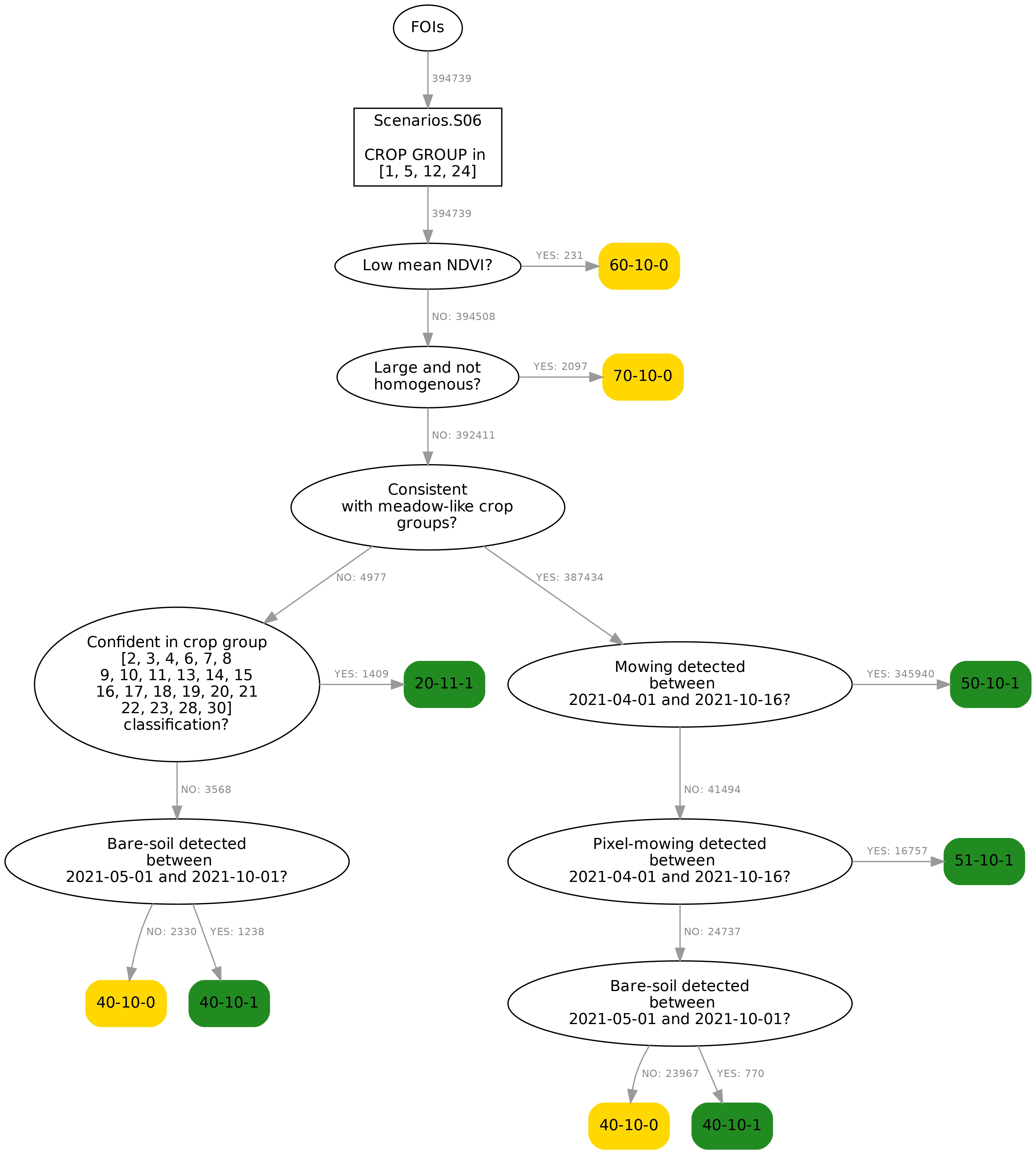
The decision tree for grassland FOIs.
Differences from the arable-land tree:
-
Low mean NDVI strongly suggests the FOI is not grassland. Grassland should be vegetated all season (one example: a permanent meadow that turned into a construction site). Such FOIs currently get Yellow, and in the future will get Red.
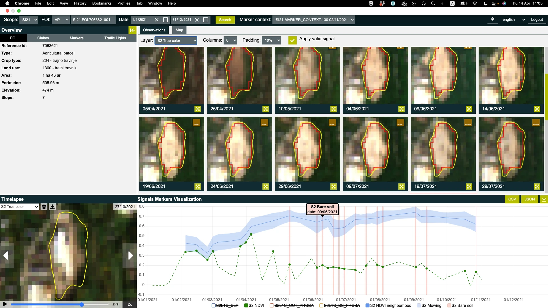
A claimed permanent meadow that turned into a construction site in April, with a bright built-up area visible by the end of October.
- Heterogeneity examples include construction on part of a parcel, multiple land uses, an arable section within a declared meadow, and multiple crops on one field.
-
Mowing is required, not just consistency. FOIs consistent with the claim do not get a Green assignment yet; an additional requirement is that they are mowed at least once per year in the specified time interval (FOI-level or pixel-level mowing). In the diagram, consistent FOIs with no mowing detected go on to the bare-soil node, where bare soil detected in the specified interval also leads to Green. Examples include a parcel mowed progressively in 5 steps over two weeks. On a parcel mowed everywhere except its northern part, the FOI-level mowing marker detected no mowing event, while the pixel-level mowing marker results suggested it had been mowed almost completely.
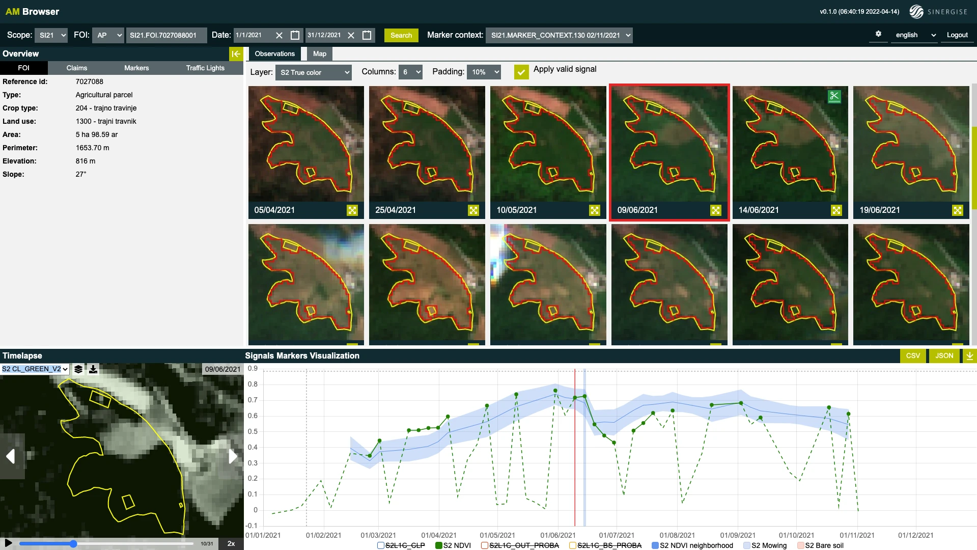
A parcel mowed in 5 steps over two weeks: each observation shows a slightly larger mowed area until the FOI is completely mowed.
-
Consistent with annual crop. If the markers indicate an annual crop (say corn) is actually growing on a claimed grassland parcel, the mowing requirement doesn't apply; the classification, similarity, and distance markers serve as the farming-activity evidence instead.
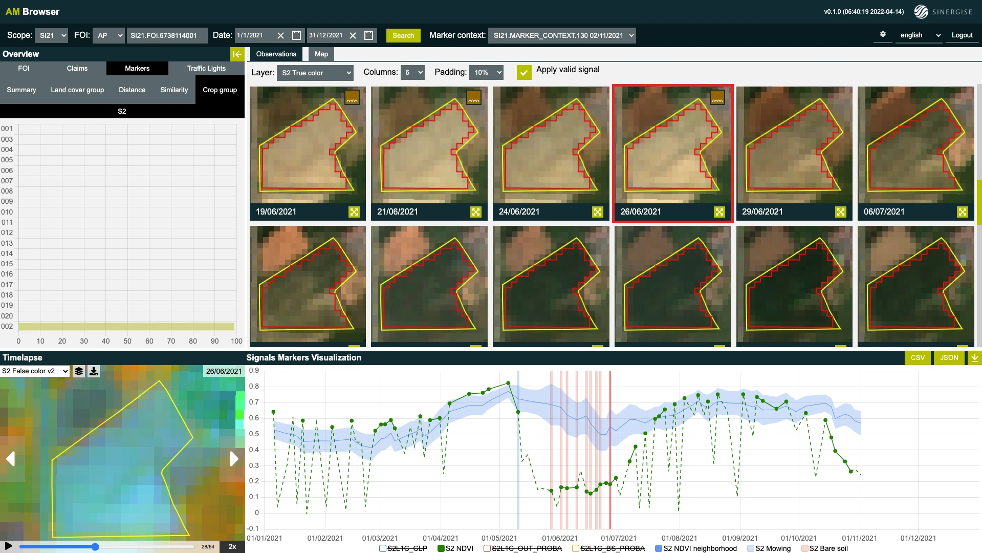
Declared permanent meadow, ploughed in May and sown with an annual crop — the markers suggest corn.
- Bare-soil detected again acts as the catch-all: any FOI reaching this node with bare soil detected in the specified interval is assigned Green, regardless of what crop is actually growing.
-
No evidence of farming. FOIs whose marker results provide no strong evidence of farming activity end the tree Yellow; these are typically FOIs consistent with their claim but with no conclusive mowing or ploughing evidence in the signals — for example, a claimed meadow the markers suggest is really a meadow, but where the mowing marker does not detect any events.
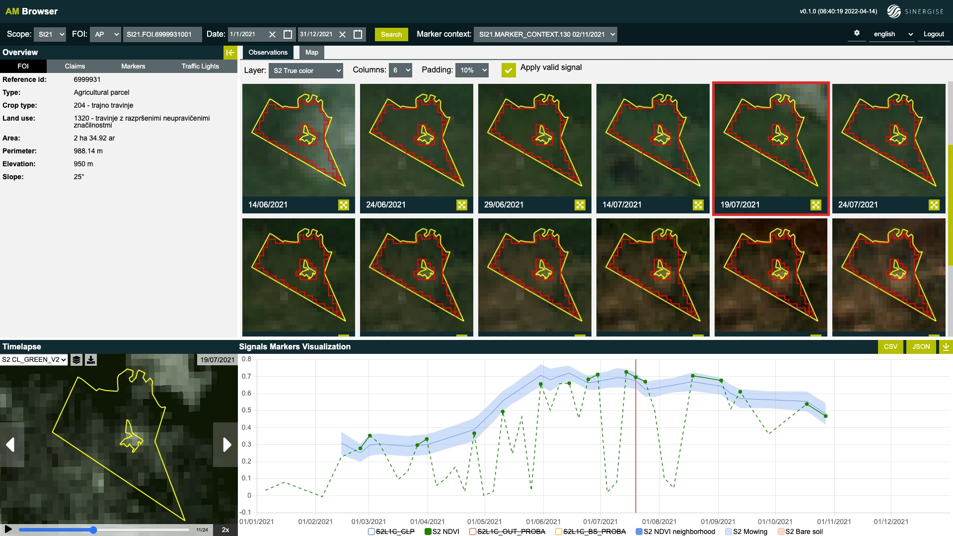
A claimed meadow the markers agree is a meadow, but with no mowing events detected — no evidence of farming activity.
Reading the trees
In the decision-tree diagrams above, numbers next to branches show how many FOIs pass through each branch, and each end node has a numeric identifier (specific to the Slovenian project — not needed to understand how TLS works). The overall design principle throughout both trees: if evidence of any farming activity is found among markers and signals for a FOI, it is assigned Green. Yellow is assigned to FOIs that have a low mean NDVI, are large and not homogeneous, or show no evidence of farming activity; in the arable-land tree, also to FOIs with no or very few valid observations. For a FOI claimed as grassland, an extremely low mean NDVI strongly suggests that it is not grassland; such FOIs are assigned Yellow at the moment but will be assigned Red in the future.
Learn more
- Traffic Light System in the Planet docs — the TLS concept, codes, and marker roles
- Traffic Light System Examples — the full decision-tree diagrams and all example parcels

Comments
Article is closed for comments.